
The evolving PFAS regulations in Canada: What you need to know
by Krista Barfoot, Melissa Birch
View post

Air dispersion modelling is the use of mathematical formulations to simulate atmospheric processes and predict the dispersion of pollutants. It is a tool used as part of an air quality risk assessment, usually to support either Environmental Permit or Planning Applications. Any facility or development that emits pollutants to air could need a dispersion modelling assessment for example:
Air dispersion modelling is typically undertaken using computer software programs such as AERMOD and ADMS-6. They are complex programs and require expert knowledge to be used effectively. The information input to a dispersion model includes:
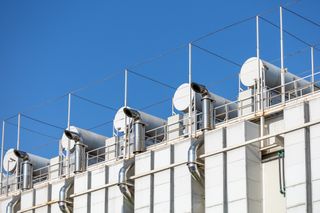
Emission parameters: stack height, diameter, velocity, temperature, mass pollutant emission rates, including details on variation through time;
Meteorological data: multiple years of hourly meteorological data are required that cover the more obvious parameters like wind speed, direction and temperature, but also include complex information on atmospheric boundary layers and require processing for local conditions, surface roughness, albedo, bowen ratio, and urban heat island effects;
Building data to assess building downwash: building downwash occurs when turbulence, caused by nearby structures (building wake effects), results in the emissions from an elevated source being dispersed rapidly towards the ground, resulting in elevated ground level concentrations;
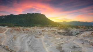
Topography: The presence of elevated terrain can significantly affect the dispersion of pollutants and the resulting ground level concentration in a number of ways, for example elevated terrain reduces the distance between the plume centre line and the ground level, thereby increasing ground level concentrations;
Mapping data and identification of sensitive receptors: most models now include some kind of satellite imagery or mapping enabling specific receptor locations of interest to be identified within a model such as potential sensitive human exposure locations (schools, hospitals, care homes etc) and designated ecological receptors (e.g. Sites of Special Scientific Interest - SSSIs).
In the UK, the Environment Agency (EA) have specific requirements for dispersion modelling assessments and reports. The EA guidance 鈥楢ir emissions risk assessment for your environmental permit鈥� [1] details when a dispersion modelling assessment will be required 鈥� most of the regulatory agencies across the UK (Natural Resource Wales (NRW), Scottish Environmental Protection Agency (SEPA) and Northern Ireland Environment Agency (NIEA)) either use this same guidance or have similar guidance. A staged approach is adopted, i.e. a screening assessment (known as Stage 1 and 2 or H1) to identify those emissions that can be considered insignificant and the requirement (if any) for detailed dispersion modelling (Stage 3).
In addition, the Environment Agency has guidance on the content of air dispersion modelling reports [2]. This detailed guidance requires that sufficient information is included to allow the assessment to be replicated and detailed justification for the various modelling inputs.
Whilst dispersion modelling is more time and cost expensive than basic assessments, it can also result in capital expenditure savings especially where it is employed early in the design process and feeds into cost-benefit-analysis, for example: a dispersion model can:
The SLR Air Quality Team can support with all aspects of air quality assessments and dispersion modelling needed to support your project, including:
If you would like further information please and we鈥檒l get back to you.
Other useful information:
When is an Air Quality Assessment required for a planning application?------------------------
References
[1] https://www.gov.uk/guidance/air-emissions-risk-assessment-for-your-environmental-permit
[2] https://www.gov.uk/guidance/environmental-permitting-air-dispersion-modelling-reports
by Krista Barfoot, Melissa Birch
by Morgan Fitzpatrick
by Jim McKinley